SMF airport status
Sacramento International Airport, Sacramento, CA KSMF
No FAA delays at SMF right now.
The FAA reports no ground stop, delay program or closure for Sacramento. Arrivals and departures are running without FAA-reported delays.
 Get a push when SMF's status changes
Weather
Observed 4:53 pm PT at the field.
METAR KSMF 242353Z 00000KT 10SM CLR 23/05 A2997 RMK AO2 SLP147 T02330050 10239 20167 56012
Forecast from 5:00 pm PT: wind variable at 5 kt, visibility 6+ sm, clear skies; then wind variable at 5 kt, visibility 6+ sm, overcast at 25,000 ft.
Full METAR, TAF and ATIS, decodedNOTAMs that matter today 4 of 14
Translated to plain English. The FAA text is one tap away.
ILS for runway 17R at Sacramento International Airport is out of service.
FAA text
07/001 NAV ILS RWY 17R IM U/S
Taxiway B3 is closed.
FAA text
10/020 TWY B3 CLSD
Minimums revised for ILS or LOC runway 17L, and RNAV (GPS) approaches to runways 17L and 35R amended. Circling category A MDA 460 ft. Temporary crane 4427 ft NE of runway 35R is in effect until ATC advises it is down.
FAA text
6/6279 IAP SACRAMENTO INTL, SACRAMENTO, CA. ILS OR LOC RWY 17L, AMDT 4D, JOBUD FIX MINIMUMS ... RNAV (GPS) Y RWY 17L, AMDT 3B ... RNAV (GPS) Y RWY 35R, AMDT 2A ... CIRCLING CAT A MDA 460/HAT 433. EXCEPT WHEN ADVISED BY ATCT THAT THIS CRANE IS DOWN. TEMPORARY CRANE 100 MSL 4427FT NE OF RWY 35R (2026-AWP-13546-OE). 2608241300-2703311312EST
RNAV (GPS) Y runway 35R amended. LNAV/VNAV DA 384 ft with visibility 1 mile; LNAV MDA 400 ft. Circling MDA 540 ft. VDP 0.98 NM to runway 35R. Several temporary cranes noted west and southeast of the airport.
FAA text
6/7370 IAP SACRAMENTO INTL, SACRAMENTO, CA. RNAV (GPS) Y RWY 35R, AMDT 2A... LNAV/VNAV DA 384/ HAT 360 ALL CATS, VIS ALL CATS 1. LNAV MDA 400/ HAT 376 ALL CATS. CIRCLING CATS A/B/C MDA 540/HAA 513. VDP 0.98NM TO RW35R. TEMPORARY CRANES 95 MSL BEGINNING 1916FT W OF RWY 35R (2020-AWP-141/142/143-NRA), TEMPORARY CRANES 120 MSL BEGINNING 2240FT W OF RWY 35R (2018-AWP-2541/2542/2543/2544/2545/2546/2547/2548-NRA), TEMPORARY CRANE 173 MSL 4519FT W OF RWY 35R (2024-AWP-4300-NRA), TEMPORARY CRANE 179 MSL 798FT SW OF SMF AIRPORT (2024-AWP-5929-NRA), TEMPORARY CRANE 133 MSL 1613FT SE OF SMF AIRPORT (2024-AWP-7256-NRA). 2605011729-2612111729EST
Frequencies
For listening and reference. Pilots use the current FAA Chart Supplement.
| Facility | MHz |
|---|---|
| SMF ATISATIS | 125.250 |
| SMF TowerTower | 125.700 |
| SMF NORCAL ApproachApproach | 125.250 |
| SMF NORCAL ApproachApproach | 125.400 |
| SMF NORCAL ApproachApproach | 127.400 |

Nearby airports
About this page
Status comes from the FAA National Airspace System status feed, runways from the SMF digital ATIS, weather from the FAA METAR and TAF for KSMF, and NOTAMs from the FAA NOTAM system, translated to plain English. Everything here is public FAA data; this site is not affiliated with the FAA and nothing on it is for navigation. Official FAA airport diagram (PDF).
SMF in the Cockpit app
The same airport, live: every plane on the ground, the weather and NOTAMs decoded, and an alert when a ground stop starts or lifts.
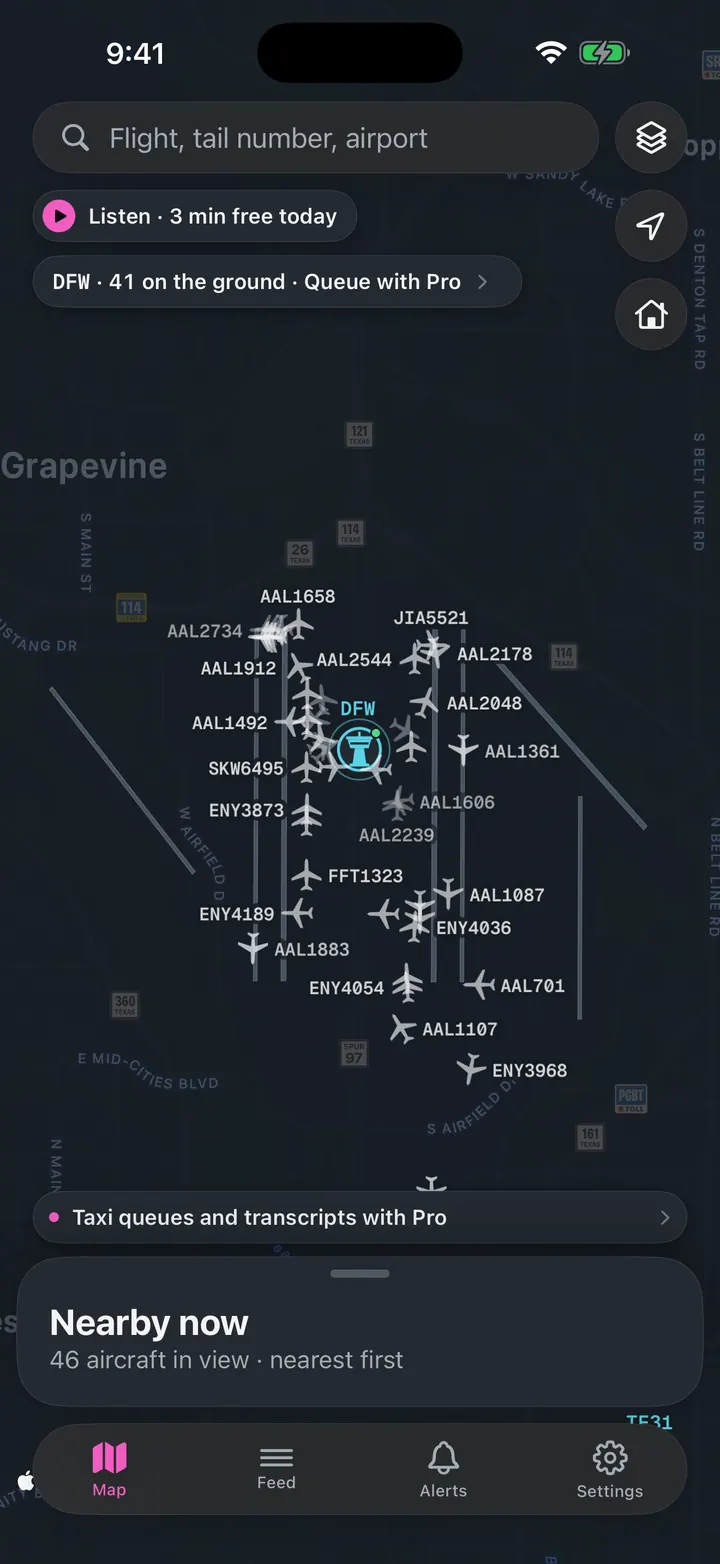
See every plane on the ground
Who is taxiing out, who is holding short, how long the departure queue is right now.
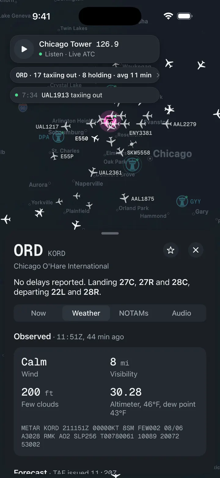
Weather and NOTAMs, decoded
Observed, forecast and ATIS in plain words, with the raw text underneath for when you want it.
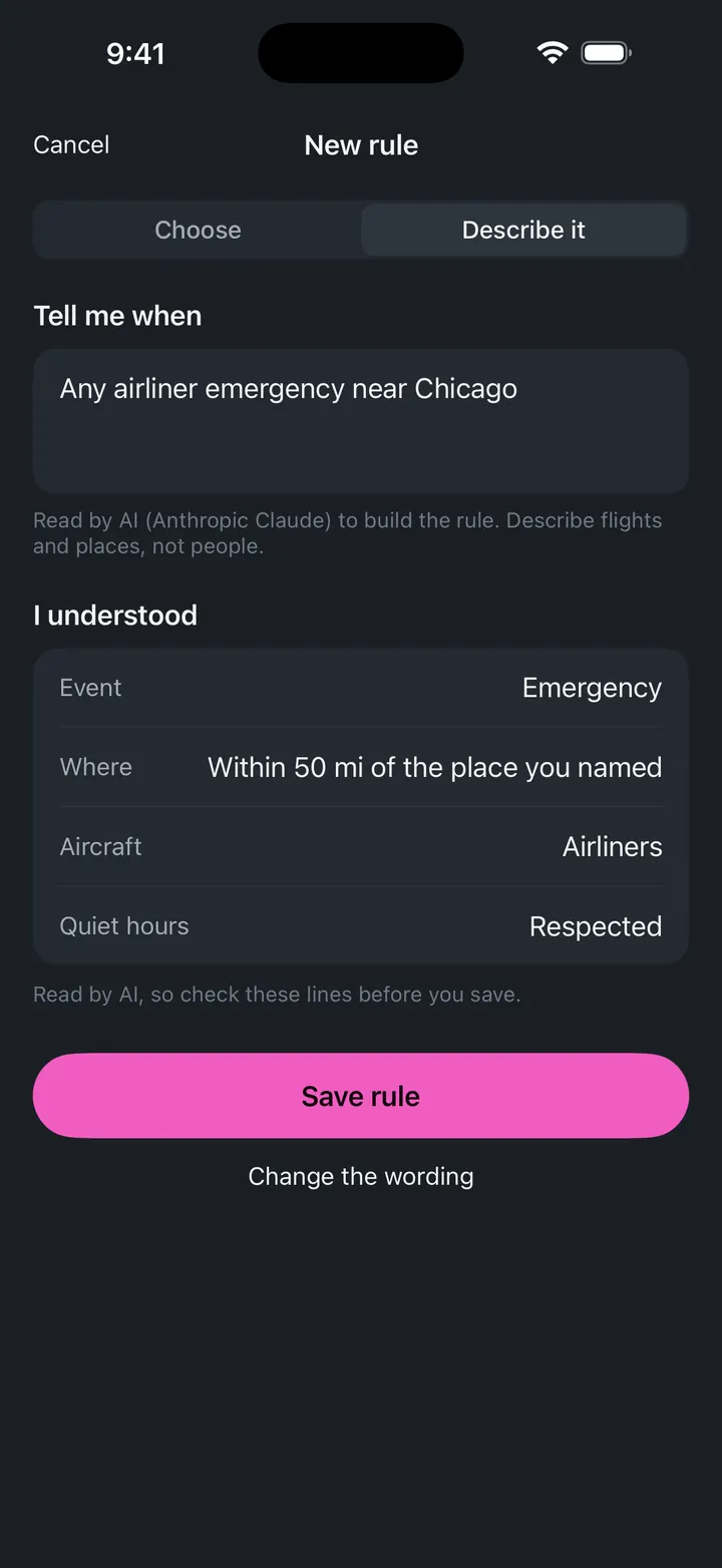
A push when a ground stop starts
Follow SMF and get notified when the FAA issues, extends or ends a stop.