SAT airport status
San Antonio International Airport, San Antonio, TX KSAT
No FAA delays at SAT right now.
The FAA reports no ground stop, delay program or closure for San Antonio. Arrivals and departures are running without FAA-reported delays.
 Get a push when SAT's status changes
Weather
Observed 6:51 pm CT at the field.
METAR KSAT 242351Z 17009KT 10SM FEW060 BKN120 BKN250 26/18 A3013 RMK AO2 SLP188 60000 T02560178 10294 20244 53004 $
Forecast from 7:00 pm CT: wind 140 at 5 kt, visibility 6+ sm, broken clouds at 5,000 ft; then wind 080 at 9 kt, visibility 6+ sm, broken clouds at 5,000 ft.
Full METAR, TAF and ATIS, decodedNOTAMs that matter today 4 of 20
Translated to plain English. The FAA text is one tap away.
ILS or LOC RWY 31L amended. S-ILS 31L decision altitude 1136 ft MSL, HAT 346 ft, RVR 3000 all categories. If approach lights are inoperative, RVR 5500 required. Several temporary cranes west, south, and northwest of runway 31L.
FAA text
6/0701 IAP SAN ANTONIO INTL, SAN ANTONIO, TX. ILS OR LOC RWY 31L, AMDT 12A... S-ILS 31L* DA 1136/HAT 346, VIS ALL CATS RVR 3000. FOR INOP ALS, INCREASE S-ILS 31L* ALL CATS VISIBILITY TO RVR 5500. DISREGARD NOTE: *RVR 1800 AUTHORIZED WITH USE OF FD OR AP OR HUD TO DA. TEMPORARY CRANES, 1049 MSL, BEGINNING 2791FT WEST OF RWY 31L (2025-ASW-2001 THRU 2005-NRA), TEMPORARY CRANE, 892 MSL, 1286FT SOUTH OF RWY 31L (2025-ASW-2305-NRA), TEMPORARY CRANE, 1115 MSL, 3836FT NW OF RWY 31L (2025-ASW-6516-NRA), TEMPORARY CRANE, 988 MSL, 2553FT WEST OF RWY 31L (2025-ASW-2006-NRA), TEMPORARY CRANE, 1029 MSL, 2973FT WEST OF RWY 31L (2025-ASW-1987-NRA). 2609031120-2709151120EST
RNAV (GPS) Y RWY 31L amended. LPV decision altitude 1136 ft MSL, HAT 346 ft, RVR 3000 all categories. If approach lights are inoperative, RVR 5500 required. Multiple temporary cranes west, south, and northwest of runway 31L.
FAA text
6/0261 IAP SAN ANTONIO INTL, SAN ANTONIO, TX. RNAV (GPS) Y RWY 31L, AMDT 2... LPV DA 1136/HAT 346, VIS ALL CATS RVR 3000. FOR INOP ALS, INCREASE LPV ALL CATS VISIBILITY TO RVR 5500. DISREGARD NOTE: *RVR 1800 AUTHORIZED WITH USE OF FD OR AP OR HUD TO DA. TEMPORARY CRANES, 1049 MSL, BEGINNING 2791FT WEST OF RWY 31L (2025-ASW-2001 THRU 2005-NRA), TEMPORARY CRANE, 892 MSL, 1286FT SOUTH OF RWY 31L (2025-ASW-2305-NRA), TEMPORARY CRANE, 1115 MSL, 3836FT NW OF RWY 31L (2025-ASW-6516-NRA), TEMPORARY CRANE, 988 MSL, 2553FT WEST OF RWY 31L (2025-ASW-2006-NRA), TEMPORARY CRANE, 915 MSL, 1566FT WEST OF RWY 31L (2026-ASW-1271-NRA), TEMPORARY CRANE, 1029 MSL, 2973FT WEST OF RWY 31L (2025-ASW-1987-NRA). 2609021407-2704142355EST
Taxiway M is closed.
FAA text
07/121 TWY M CLSD
ILS or LOC RWY 4 amended. ILS decision altitude 1149 ft MSL, HAT 363 ft, all categories. LOC minimums 1280 ft MSL, all categories. Visibility RVR 6000 for categories C/D. Circling minimums apply. Disregard Zinon fix altitude. Two tempora...
FAA text
6/6244 IAP SAN ANTONIO INTL, SAN ANTONIO, TX. ILS OR LOC RWY 4, AMDT 23... S-ILS 4 DA 1149/HAT 363 ALL CATS. S-LOC 4 MDA 1280/HAT 494 ALL CATS. VIS CATS C/D RVR 6000. CIRCLING CAT A/B MDA 1400/HAA 591. VDP NA. DISREGARD ZINON FIX MINIMUMS AND ZINON FIX ALTITUDE. TEMPORARY CRANE, 1277FT NW OF RWY 4 (2026-ASW-1780-NRA), TEMPORARY CRANE, 915 MSL, 1389FT NORTH OF RWY 4 (2026-ASW-1271-NRA). 2607162011-2801152011EST
Frequencies
For listening and reference. Pilots use the current FAA Chart Supplement.
| Facility | MHz |
|---|---|
| SAT ATISATIS | 118.050 |
| SAT San Antonio Clearance DeliveryClearance delivery | 126.700 |
| SAT Clearance Delivery/GroundGround | 121.900 |
| SAT San Antonio TowerTower | 119.800 |
| SAT San Antonio ApproachApproach | 120.550 |
| SAT San Antonio ApproachApproach | 125.100 |
| SAT San Antonio ApproachApproach | 125.700 |
| SAT San Antonio ApproachApproach | 127.100 |
| Houston CenterCenter | 125.625 |

Nearby airports
About this page
Status comes from the FAA National Airspace System status feed, runways from the SAT digital ATIS, weather from the FAA METAR and TAF for KSAT, and NOTAMs from the FAA NOTAM system, translated to plain English. Everything here is public FAA data; this site is not affiliated with the FAA and nothing on it is for navigation. Official FAA airport diagram (PDF).
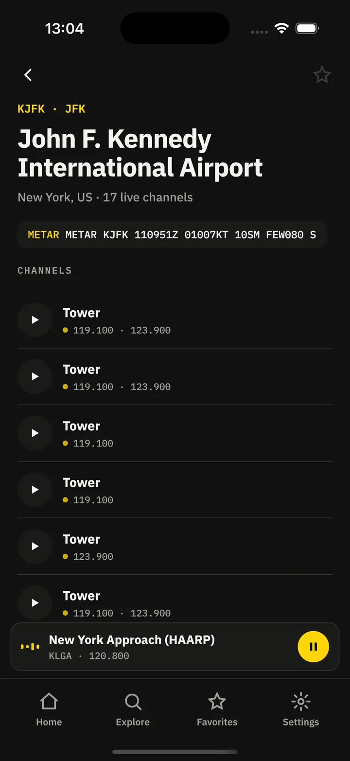
SAT in the Cockpit app
The same airport, live: every plane on the ground, the weather and NOTAMs decoded, and an alert when a ground stop starts or lifts.
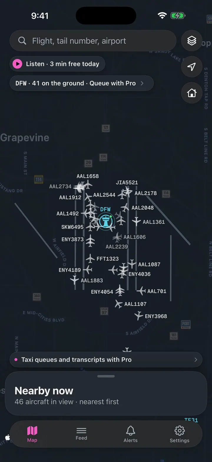
See every plane on the ground
Who is taxiing out, who is holding short, how long the departure queue is right now.
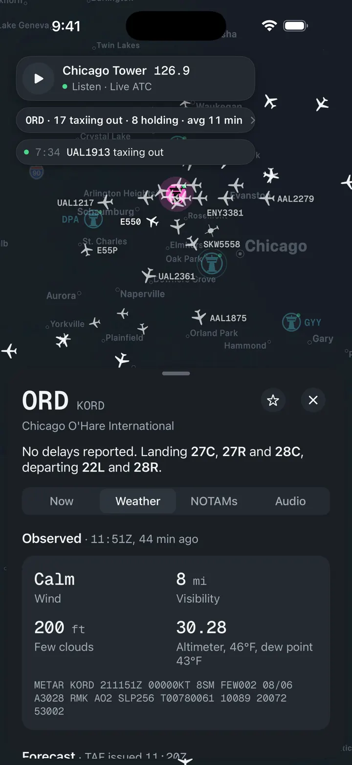
Weather and NOTAMs, decoded
Observed, forecast and ATIS in plain words, with the raw text underneath for when you want it.
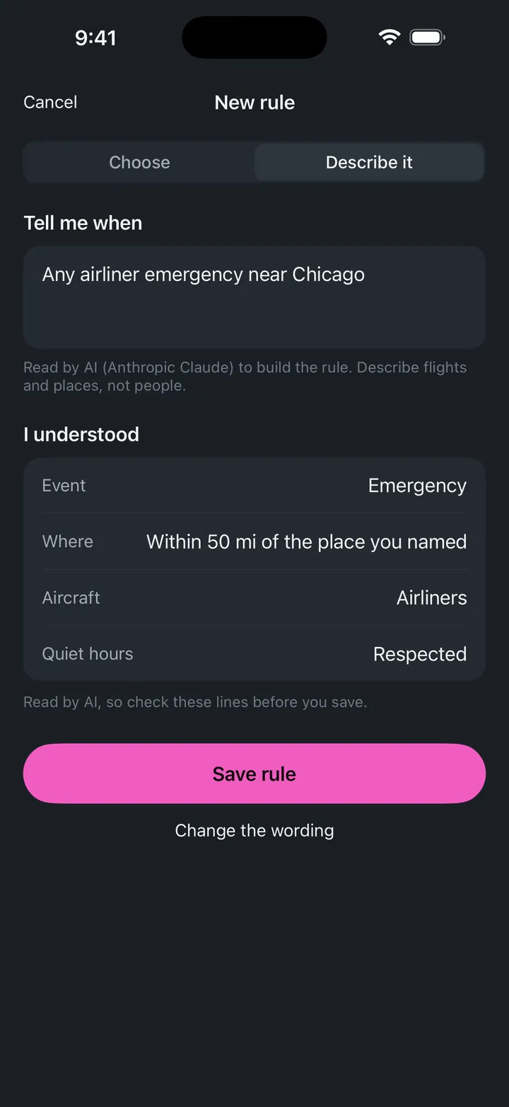
A push when a ground stop starts
Follow SAT and get notified when the FAA issues, extends or ends a stop.