PHX airport status
Phoenix Sky Harbor International Airport, Phoenix, AZ KPHX
No FAA delays at PHX right now.
The FAA reports no ground stop, delay program or closure for Phoenix Sky Harbor. Arrivals and departures are running without FAA-reported delays.
 Get a push when PHX's status changes
Weather
Observed 4:51 pm MST at the field.
METAR KPHX 242351Z 35008G18KT 10SM FEW070 SCT090 SCT140 SCT250 24/06 A2991 RMK AO2 SLP116 CB DSNT NE AND NW-N T02440061 10250 20228 53004 $
Forecast from 5:00 pm MST: wind 310 at 8 kt, visibility 6+ sm, scattered clouds at 8,000 ft; then wind variable at 4 kt, visibility 6+ sm, clear skies.
Full METAR, TAF and ATIS, decodedNOTAMs that matter today 4 of 44
Translated to plain English. The FAA text is one tap away.
Pyrotechnic demonstration within a 0.5 nautical mile radius of PXR090002, surface to 400 feet AGL.
FAA text
10/087 AIRSPACE PYROTECHNIC DEMONSTRATION WI AN AREA DEFINED AS .5NM RADIUS OF PXR090002 SFC-400FT AGL
RNAV (GPS) Y RWY 25R approach amended with LNAV/VNAV DA 1660 ft HAT 526 ft and LNAV MDA 1660 ft HAT 526 ft, visibility 1.5 miles for all categories. Temporary cranes up to 200 ft AGL (1342 ft MSL) starting 1.1 NM southeast of runway 25R.
FAA text
6/0641 IAP PHOENIX SKY HARBOR INTL, PHOENIX, AZ. RNAV (GPS) Y RWY 25R, AMDT 2C... LNAV/VNAV DA 1660/HAT 526, VIS 1 1/2 ALL CATS. LNAV MDA 1660/HAT 526, VIS 1 1/2 ALL CATS. TEMP CRANES STARTING 1.1NM SE OF RWY 25R, UP TO 200 AGL/1342 MSL (2026-AWP-14067-OE). 2610231200-2611301251EST
RNAV (GPS) Y Runway 7L amended. LNAV/VNAV DA 1563/HAT 446, LNAV MDA 1660/HAT 543. Temporary crane 1352 feet MSL, 2430 feet south of Runway 7L. Effective until late January.
FAA text
6/1723 IAP PHOENIX SKY HARBOR INTL, PHOENIX, AZ. RNAV (GPS) Y RWY 7L, AMDT 1C... LNAV/VNAV DA 1563/HAT 446, ALL CATS. LNAV MDA 1660/HAT 543 ALL CATS. TEMP CRANE 1352 MSL, 2430FT S OF RWY 7L (2026-AWP-4528-OE). 2610231200-2701291839EST
RNAV (GPS) Y approach to runway 7R amended. Crane 1352 feet MSL about 1830 feet south of runway 7L, temporary.
FAA text
6/1725 IAP PHOENIX SKY HARBOR INTL, PHOENIX, AZ. RNAV (GPS) Y RWY 7R, AMDT 1C... LNAV/VNAV DA 1563/HAT 447, ALL CATS. LNAV MDA 1660/HAT 544 ALL CATS. TEMP CRANE 1352 MSL, 1830FT S OF RWY 7L (2026-AWP-4528-OE). 2610231200-2701291839EST
Frequencies
For listening and reference. Pilots use the current FAA Chart Supplement.
| Facility | MHz |
|---|---|
| PHX Ground (North/Pri)Ground | 119.750 |
| PHX Tower (North/South)Tower | 118.700 |
| PHX Tower (Emergency)Tower | 134.850 |
| PHX Phoenix Approach/Departure (Pima 123.7/Willy 124.9)Approach | 123.700 |
| PHX Phoenix Approach (North Final)Approach | 126.600 |


Nearby airports
About this page
Status comes from the FAA National Airspace System status feed, runways from the PHX digital ATIS, weather from the FAA METAR and TAF for KPHX, and NOTAMs from the FAA NOTAM system, translated to plain English. Everything here is public FAA data; this site is not affiliated with the FAA and nothing on it is for navigation. Official FAA airport diagram (PDF).
PHX in the Cockpit app
The same airport, live: every plane on the ground, the weather and NOTAMs decoded, and an alert when a ground stop starts or lifts.
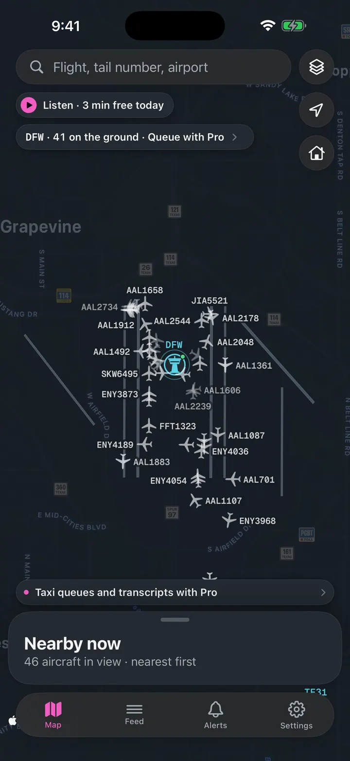
See every plane on the ground
Who is taxiing out, who is holding short, how long the departure queue is right now.
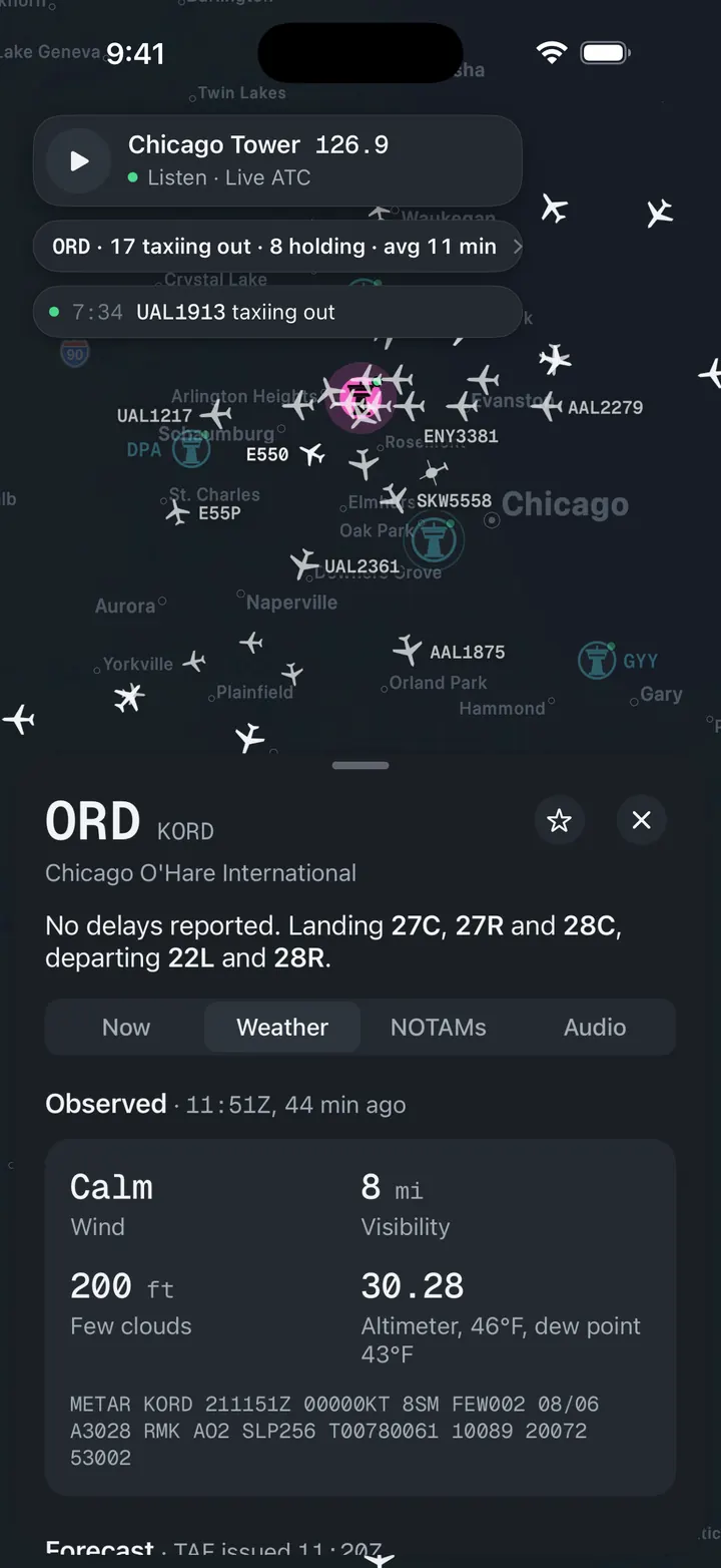
Weather and NOTAMs, decoded
Observed, forecast and ATIS in plain words, with the raw text underneath for when you want it.
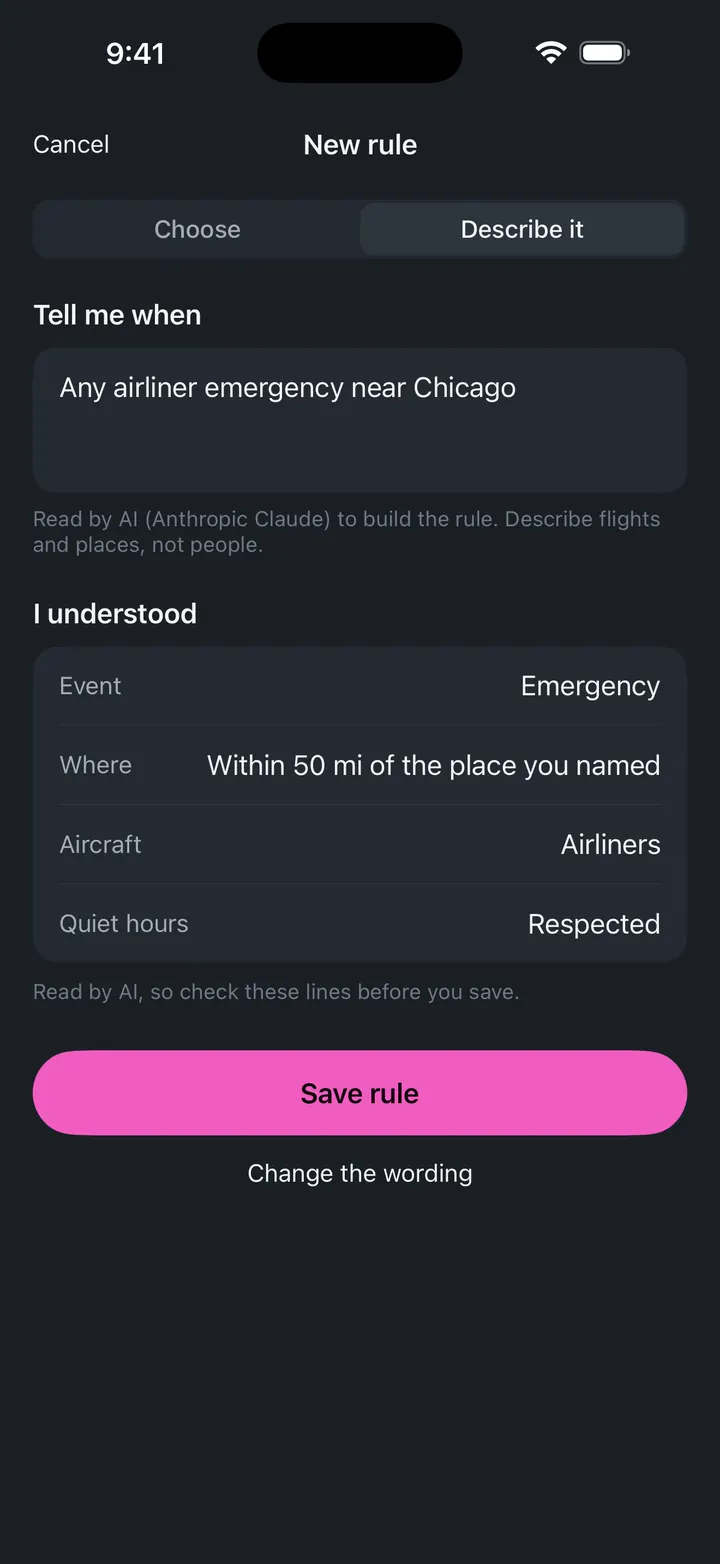
A push when a ground stop starts
Follow PHX and get notified when the FAA issues, extends or ends a stop.